When the rails were laid and steam engines began pushing to the center of the country, the railroad transformed the land. In Northwest Nebraska, towns like Chadron, Crawford and Harrison thrived in part from the railroad, and others like Glen, Belmont and Orella would gain relevance, but later all-but-disappear when some railways and services were abandoned.
The allure of the railroad is strong, and Northwest Nebraska has more than its share of history to offer enthusiasts, including several historic sites along the famous “Cowboy Line.”
Let this bucket list serve as a guide to see explore each of them.
Railroad roundhouses are structures that provide stalls for the storage and maintenance of locomotives. They were traditionally circular in shape and built around a turntable which allows locomotives and other rail cars to be turned 360 degrees.
Modern roundhouses still carry the old moniker, but are typically no longer round and relatively few traditional examples exist around the world.
Chadron’s roundhouse was built in the late 1800s and serviced the steam engines of the famous Cowboy Line railway, originally laid by the Fremont, Elkhorn, Missouri Valley Railroad. The building is one of four in Nebraska and one of two that has kept its turntable.
It changed hands to the Chicago and North Western Railroad not long after its creation and persisted as such for around 90 years.
In 1910, 16 engines were destroyed and half-a-million-dollars worth of damage was done to the roundhouse when a massive fire broke out in the building. Despite worries it would mean the end of the railroad business in Chadron, the roundhouse was rebuilt and service continued. It was boasted that during and in the immediate aftermath of the fire, not a single train in the division was delayed – a testament to the expertise and hard work of the men of the C&NW.
Today the roundhouse and turntable remain in operation thanks to Nebraska Northwestern Railroad who resurrected the railroad business in Chadron some years after the departure of C&NW. NNW uses the roundhouse to store and service locomotives and provides other niche services like car storage along its short line.
Visitors are welcome to visit the roundhouse and should contact NNW General Manager Jim Collins to arrange a tour. Mr. Collins can be reached at 308-760-8927.
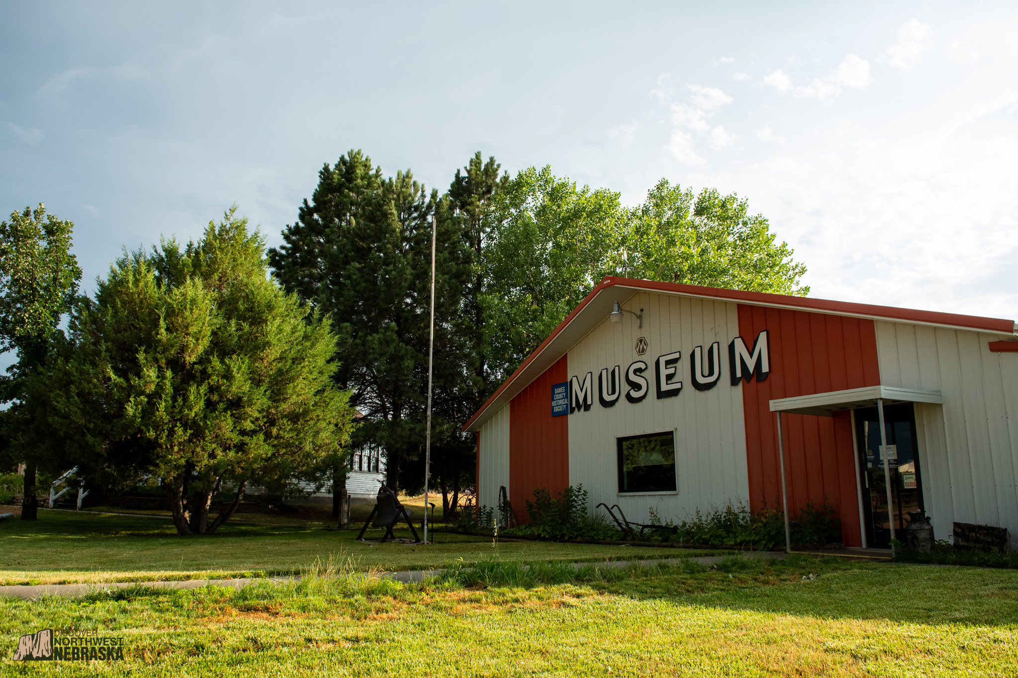
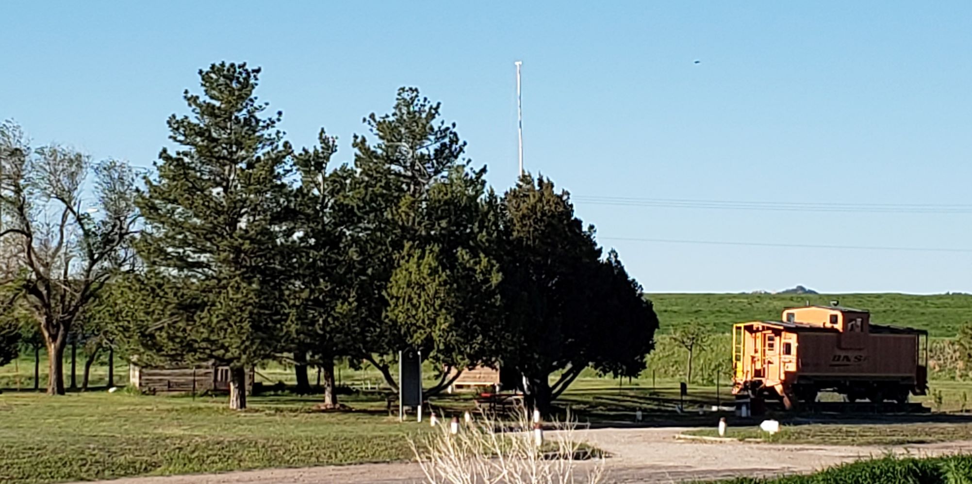
Located three miles southwest of Chadron, the Dawes County Historical Museum houses an impressive collection of pioneer and early-Nebraska antiques, including a collection of items from the days of the Chicago & Northwest Railroad “Cowboy Line,” including a C&NW caboose.
Other items at the museum include blacksmith tools, farm machinery, vintage quilts and more. Among the nostalgic room displays are replicas of a general store, a hospital room and a railroad room. Guests can explore the log house, barn, 1890s schoolhouse, and pioneer church on the museum grounds.
Don’t miss History in Action Day, an annual event held on the second Sunday of September. The entire family can enjoy buggy rides, horse shoe pitching, music, and demonstrations of butter churning, wool spinning, rope making and apple cider making.
Crawford started as a tent city in 1886 and was named after a Fort Robinson soldier.
The town served as an important supply depot and entertainment center for soldiers stationed at the Fort.
The visitors center is not only a great place to learn about the town of Crawford, it’s also the perfect place to stop for lunch, or to stretch your legs. Like many visitors centers around the country, Crawford’s features a caboose once used on the nearby Burlington Northern railroad. The Visitors Center is open Memorial Day – Labor Day and is located at the Junction of Highways 2/20.
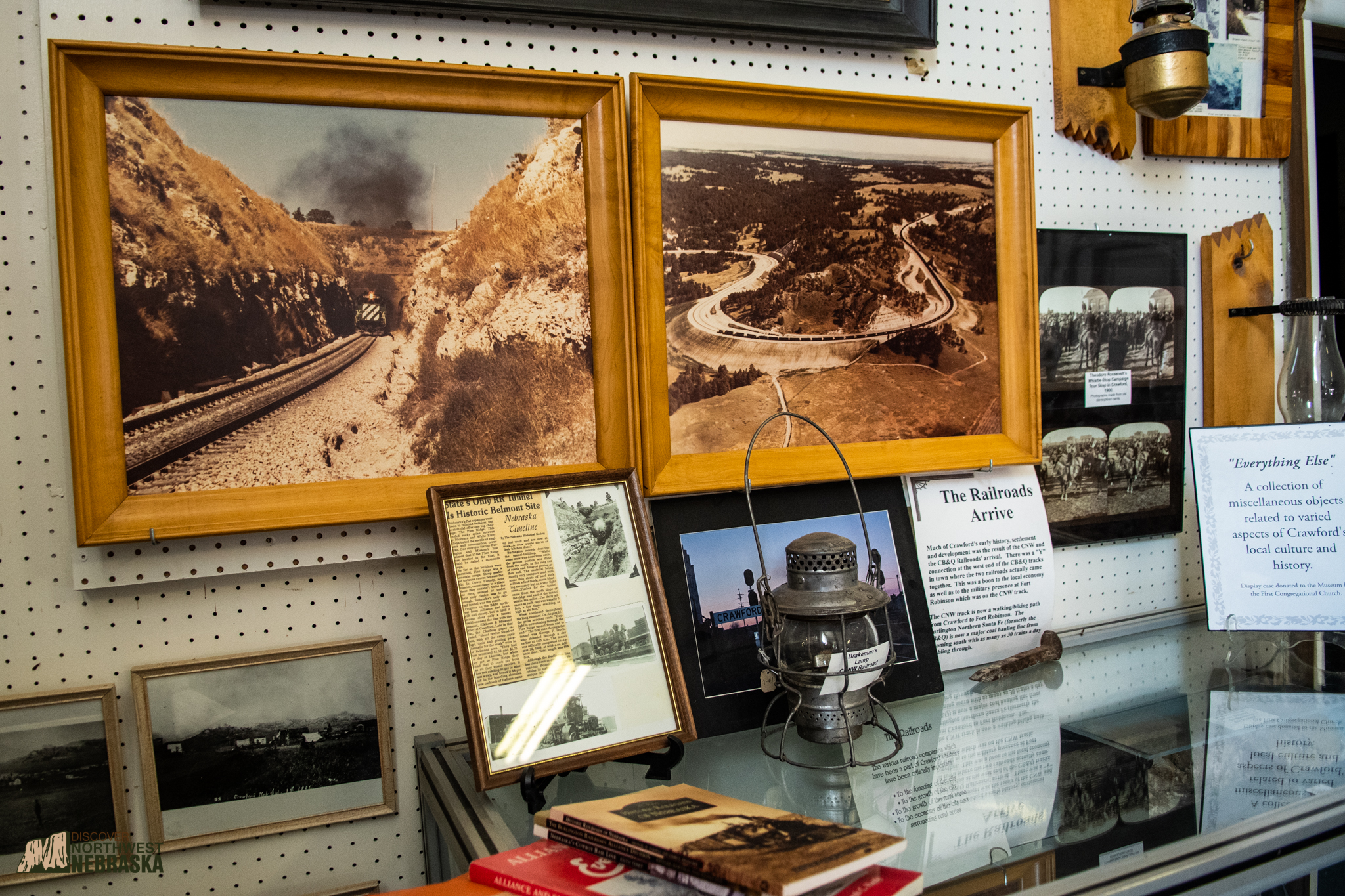
The Crawford Historical Museum, located in the heart of downtown Crawford, is operated by the Crawford Historical Society to preserve and protect Crawford’s history and culture. The displays reflect the early people, economy, and social interests of Crawford. The Museum’s collection is a dynamic thing, growing and changing as acquisitions, needs and interests demand. The museum was established in its current location in 1992 after the disastrous White River flood destroyed the former building, located in the City Park. It now is housed in the Crawford Cultural Center building through the generosity of Crawford’s municipal administration. Many of the items in the Museum are post-flood acquisitions, a testament to the industry, generosity, and concern of the residents of the area.
Items of interest for railroad enthusiasts include ledgers and lanterns from The Cowboy Line as well as photos of the Crawford Hill and Belmont Tunnel areas.
The Museum is divided into several interest areas: Pre-history, the Native American interest, Traders & Trappers, the Military Presence at Fort Robinson, the Development and Cultural Growth of Crawford, Farming & Ranching, the Schools, and specific Business and Organizational interests.
The Crawford Historical Museum is located at 341 2nd St. in Crawford; admission is free. The museum is open from mid-May to mid-October from 10 am to 4 pm Monday through Saturday.
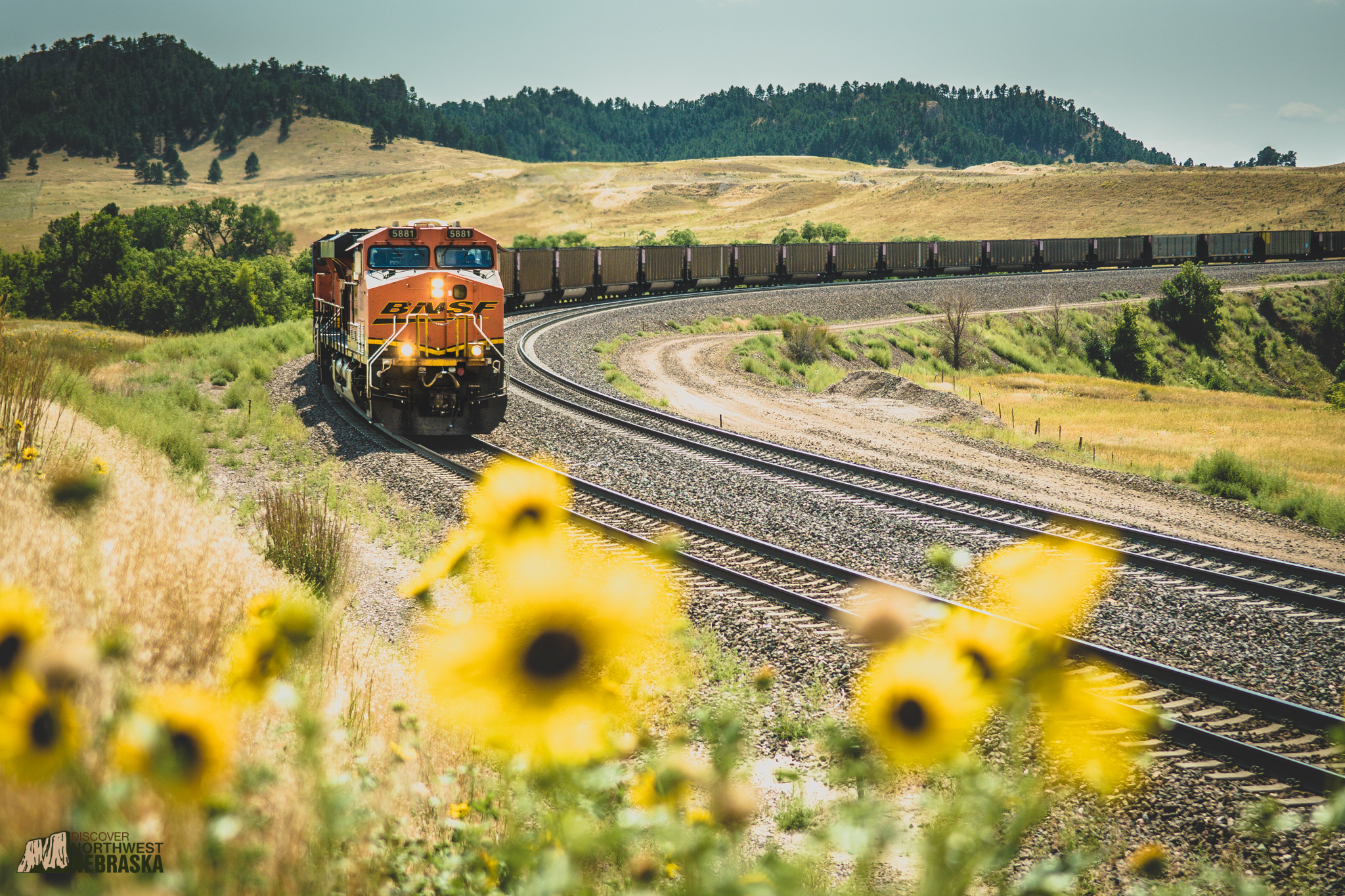
Located near Milepost 440 on Toadstool Road, Orella Hill may not be as picturesque as Crawford Hill, but the climb east over its summit is just as technically challenging for passing trains and often requires the same helper engines.
Orella Hill serves as a sort of testing ground for trains headed east toward Crawford Hill. If a train can keep a minimum speed of of 16 miles-per-hour throughout the climb, without helpers, it can do the same over Crawford Hill.
The first settlers near what would become Orella, Nebraska were ranchers who set up operations along Cottonwood Creek. In 1889, when the railroad passed through the area, a railroad office was located at the site that would officially become the town of Orella in 1906.
The town was a railhead for shipping cattle and at one time had a small railyard and was home to the railroad’s track gang until it was relocated to Crawford in 1960. The railhead also offered passenger car service.
Eventually, multiple stores, a stable and a church would be located in Orella, along with a post office that operated until 1957 when passenger car service ended. Like many railroad towns in the region, Orella’s population began to decline during the depression of the 1930s and improvements to roads and automobiles made the larger population centers in the area more popular.
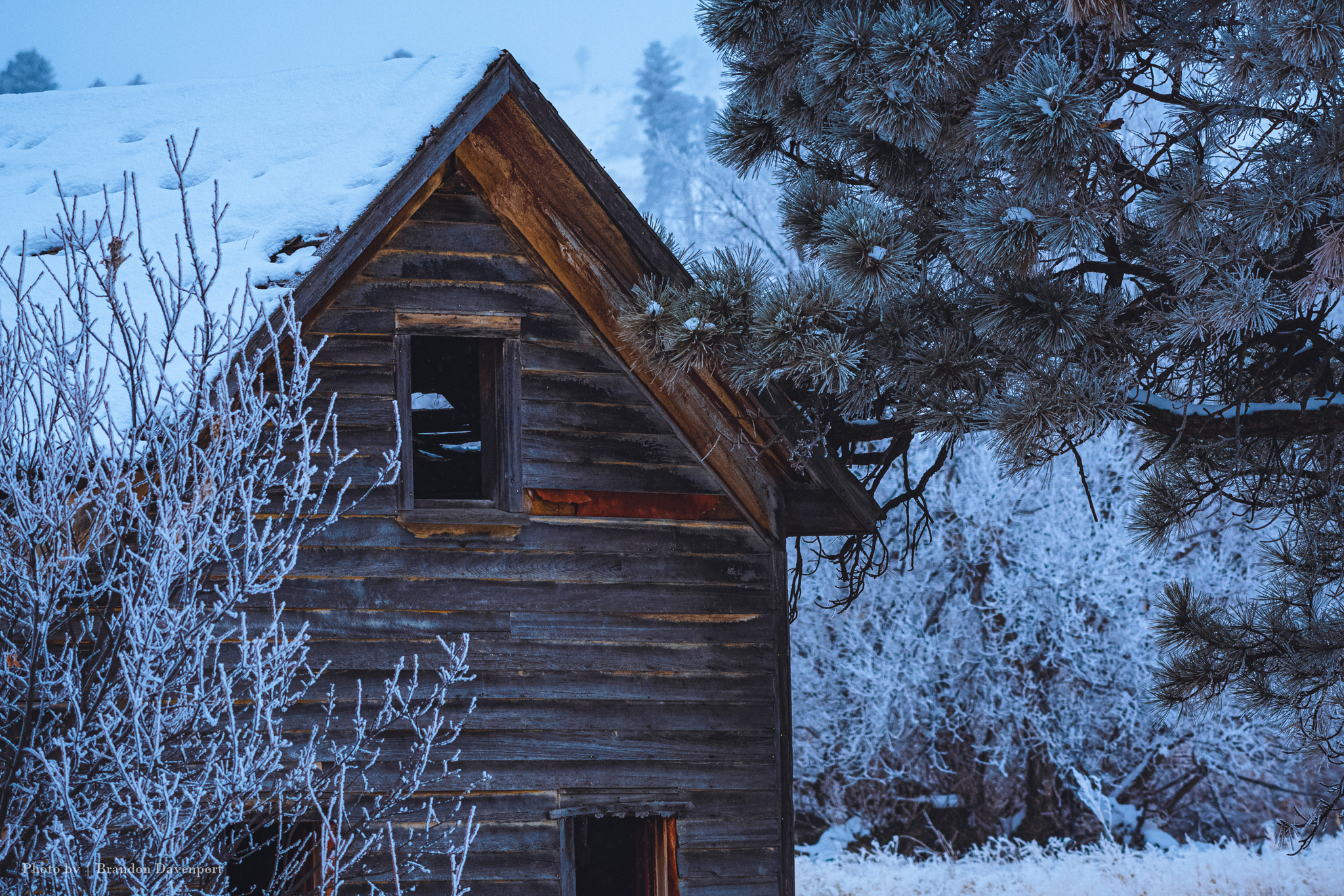
All that remains of Orella today are a residence, the railroad section foreman’s house and the train station – although the foreman’s house and station were moved away from the tracks and converted to a private corral. Trespassing is not allowed on the property.
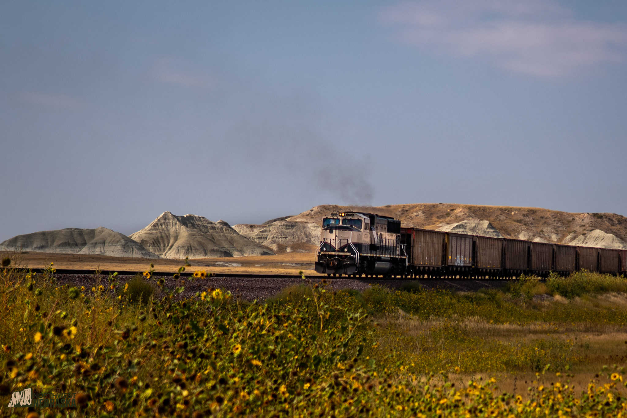
Burlington Northern trains traveling through the railroad’s Butte Subdivision face the challenge of traversing two significant hills – Orella Hill and Crawford Hill. Crawford Hill is located between Sawlog Road and Belmont.
Eastbound, Crawford Hill averages a grade of about 1.55-percent over the 13 miles between the town of Crawford, Nebraska and the ghost town of Belmont, Nebraska. It uses two 10-degree double-horseshoe curves to rise 800 feet. Trains making the climb often need the assistance of helper engines based out of Crawford.
The railway was built in 1889 by the Chicago, Burlington and Quincy Railroad to connect Alliance, Nebraska, with Edgemont, South Dakota, in order to compete with the nearby Fremont, Elkhorn and Missouri Railroad’s famous “Cowboy Line.”
A merger of several railroads saw Burlington Northern take over the line in March of 1970. In the mid-70s, a boom in the coal industry in Wyoming’s Powder River Basin meant increased traffic and heavier trains making their way through the Pine Ridge of Northwest Nebraska.
The increased weight meant trains now needed helper engines that could assist in the climb. In Crawford, trains would drop their caboose, hook up the helper engines, tie the caboose to the helpers, climb the hill and reverse the process in Belmont. Once the helper units were detached, the train regained its caboose and traveled on to Alliance.
In 1981, the route was reengineered to remove tight curves and add a second main line. It was during this remodeling that the Belmont Tunnel, Nebraska’s only rail tunnel, was abandoned and a cut was made in the bluff adjacent to it to house new track.
Many viewing locations for this portion of the line are located entirely on private property, but nearby public roads run along the track and offer the opportunity to watch trains make their way up the hill. For more information, scroll to the “Viewing/Photography Sites” section of this page.
The only of its kind in Nebraska, the Belmont Tunnel was used by the Chicago, Burlington and Quincy Railroad (and later Burlington Northern) for nearly 100 years from 1889 to 1982. Construction of the tunnel, which was done by hand, took a considerable amount of man power and took two years to complete. The tunnel was the final obstacle to be overcome in connecting the rail line from Alliance, Nebraska, to Crawford, Nebraska.
The tunnel would prove to be essential to Belmont and Marsland, small towns that owed their growth to the passing railroad. A 1981 re-engineering of the route abandoned the Belmont Tunnel in favor of cutting out a nearby bluff and adding a second line.
The tunnel is now off-limits to visitors and cannot be accessed, but those traveling to Belmont can view the cut and the side of the tunnel from the town of Belmont.
The White River Trail takes hikers from Crawford City Park (1st and Main Street in Crawford, Nebraska) to Fort Robinson State Park.
The three-mile (one-way) Rail Trail offers railroad enthusiasts the chance to hike along the path where the “Cowboy Line” once ran, and cross bridges that once carried old steam engines across the White River.
Trail users can expect to see plenty of wildlife along the way, including long-horn cattle, deer, turkey, raptors and eagles depending on the time of year. Parking is available at the trailhead at Crawford Park as well as at Fort Robinson State Park (permit required).
This bucket list item is from our Roads Less Traveled road trip series and takes adventurers through one of the earliest settled areas in the region.
The road trip follows the White River southwest of Fort Robinson. Because the “Cowboy Line” also follows the White River in this area, it’s a great way to travel beside what remains of the line as it snakes through one of the most picturesque areas in Northwest Nebraska.
Along the way you’ll encounter the ghost towns of Glen and Andrews, former towns which originally grew out of the presence of the railroad – and disappeared with it too.
You’re sure to run into plenty of wildlife in this area and much of the river is open to public fishing, allowing you to try your luck at landing a trout right next to an old “Cowboy Line” rail bridge.
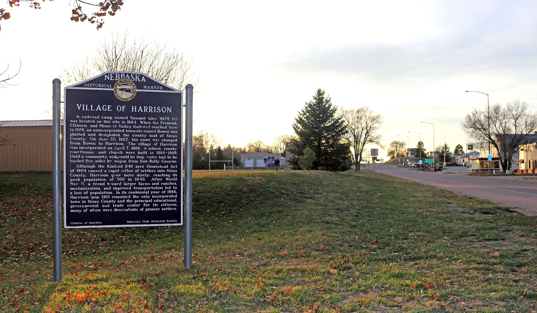
What is now the Village of Harrison began as a humble railroad camp called Summit in 1884. Then, when the “Cowboy Line” reached the area in 1886, a township named Bowen was designated and made the seat of Sioux County. Finally, in 1887, the town’s name was changed to Harrison and was incorporated in April of 1888.
Harrison is Nebraska’s highest town at an elevation of 4,876 feet. The town is the northern gateway to Agate Fossil Beds National Monument located 25 minutes south of Harrison. North of Harrison is Gilbert-Baker Wildlife Management Area a great place to hike and camp.
The remains of a railroad depot loading dock can be viewed along First Street, and you can stay at the Harrison House Hotel, built in 1886 by the Chicago Northwestern Railroad.
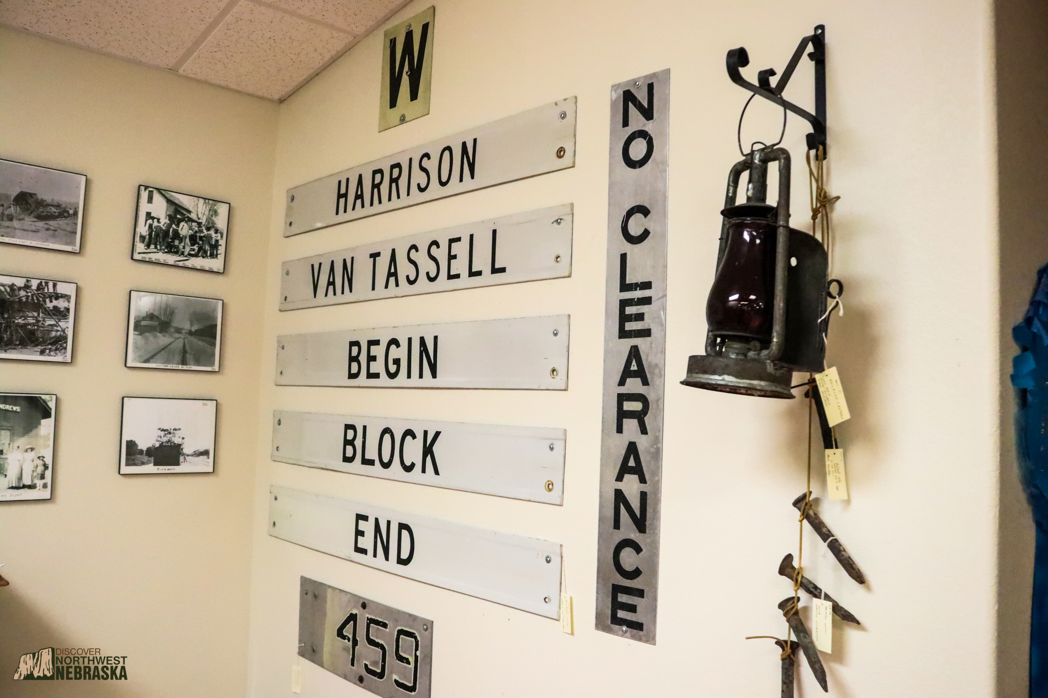
The Sioux County Museum features several buildings, including a historic schoolhouse and telephone office. All are filled with numerous artifacts and exhibits related to the past of Harrison and Sioux County. Railroad enthusiasts will enjoy the museums photo collection of the “Cowboy Line.” Visitors will also find a collection of markers and lanterns from the line.
The museum also sponsors the Sioux County Historical Trek each September, which guides participants in exploring local sites and history in Sioux County and the surrounding area.
The museum is located on Main Street in Harrison, Nebraska, and is open Memorial Day through Labor Day – 10:00 a.m. to 4:00 p.m. Monday through Saturday, and 1:00 p.m. to 4:00 p.m. on Sunday.
The famous Cowboy Line railway reached Harrison, Nebraska, in June of 1886. In August, Charles Franklin Coffee shipped the first train load of cattle from Harrison to Chicago, Illinois.
Coffee was born in Missouri, but cut his teeth in the ranching industry as a Texas cowboy before eventually running his own operation, Hat Creek Ranch, near Harrison.
Railroad sidings are sections of track that diverge from the main line and offer, among other uses, the opportunity for loading or unloading cargo. Coffee Siding was established along Highway 20 between Harrison and the Wyoming-Nebraska border to avoid high freight costs in Wyoming and became a prominent shipping location for Nebraska ranchers and even some from Wyoming. Coffee had built several cattle pens along the siding.
Coffee’s success in ranching in the region opened other doors for him. In 1895, he struck a deal, purchasing Bartlett Richards’s controlling share of First National Bank, in Chadron, for 2,000 head of cattle with calves. He also managed to get Chadron’s finest home in the deal. Over the next several decades the Coffees would become one of the preeminent families in the region.
Road improvements and cattle trucks eventually pushed out shipping by rail and in the late 1950s Coffee Siding, like many others, was abandoned. All that remains today is a State Historical Marker.
Coming Soon: The Cowboy Trail
The once famous “Cowboy Line” railroad is now part of the Great American Rail Trail being developed to cross the U.S. coast-to-coast. The Cowboy Trail, under management by Nebraska Game and Parks, begins in Norfolk and covers 317 miles to Chadron. While 200 miles of the trail conversion is complete, the portion in Northwest Nebraska is not yet finished. Plans are underway to connect completed portions in Sheridan County (to the east) to Chadron.
Once opened, the trail will provide hikers and bicyclists with sweeping curves and a relatively flat grade.
Along the way, trail users will cross railroad bridges and historic stone culverts. The stone arch culverts were built in the late 1800s and early 1900s and are more prevalent in Northwest Nebraska than they are further east. They served as drainage structures and livestock underpasses. To read more about these historic culverts, click here.
Disclaimer: Extreme caution should be used when viewing or photographing trains. Keep your distance from the tracks when viewing or photographing and never – in any situation – place yourself or anyone in your party on the tracks. Injury and death can occur if caution is not used.
As always when traveling the back roads of Northwest Nebraska, respect private property and do not trespass where it is not allowed.
The railways that run north and south of Crawford, Nebraska, offer the best viewing of active trains in Northwest Nebraska as they pass over Crawford Hill to the South and Orella Hill to the north.
-Southeast of Crawford, Sawlog Rd, which runs west to east about two miles south of Crawford, connects with Saw Logging Rd, which runs alongside the track northwest to southeast. These roads provide a long stretch of viewable track and multiple spots that are suitable for photography.
-Further south, Breakneck Rd near Belmont, Nebraska, offers more viewing. From Crawford, take Highway 71 south to North Belmont Rd. Turn east on North Belmont and proceed about a mile to the intersection with Breakneck Rd. Turn south here toward Belmont.
-North of Crawford, Toadstool Rd runs parallel to the railway for several miles and offers a number of locations suitable to photographers. Perhaps the best is at the junction of Toadstool and Orella Roads near the former town of Orella. To reach Toadstool Rd, head north on Highway 71 for about five miles to the intersection with Toadstool Rd. Turn west and follow the road as it eventually turns north to run alongside the railway. From here adventurers can travel alongside the track nearly all the way to South Dakota.