BUCKET LIST
Looking across the landscape of Dawes and Sioux Counties, a person can almost look back into time, visualizing the days of roaming bison and Lakota hunting parties making their way through the bluffs of the Pine Ridge.
From the site of Crazy Horse’s surrender and eventual death, to the battlefields of the Indian Wars and attempts to purchase the Black Hills, Northwest Nebraska was an area of significance during the United States’ western expansion. Before those tumultuous times the region was the home and fertile hunting grounds of the Lakota and other tribes.
While some places of significance remain unknown or have been lost to time, several destinations and monuments honoring the region’s sometimes tumultuous Native American history are must-see destinations.
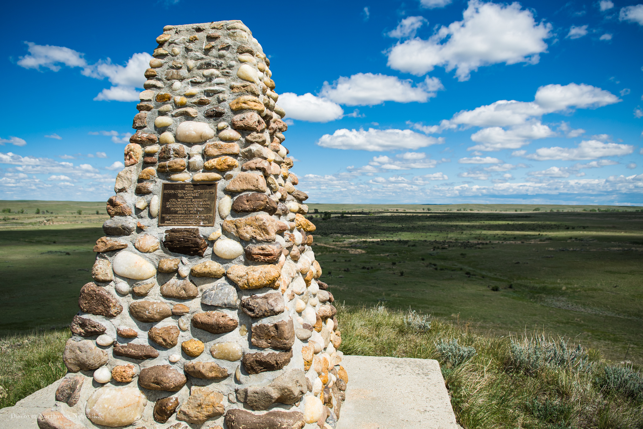
Located just north of the Immaculate Conception Catholic Church and the now defunct town of Montrose north of Harrison, a pair of monuments honor the events of the Battle of Warbonnet Creek, where the U.S. 5th Cavalry turned away what was rumored to be 800 Cheyenne who were attempting to link up with Sitting Bull in the weeks following his victory against Custer.
The battlefield monument sits on a hill that would later house a civilian-built fort that served to protect Montrose during tensions that arose during the Ghost Dance War. Closer to the road, just across Warbonnet Creek, head east from the trail to the battlefield monument and you’ll find another marking the encounter that led to the only casualty of the battle.
At this site, William “Buffalo Bill” Cody killed and scalped the Cheyenne Yellow Hair as he and a group of warriors were attempting to cut off a pair of couriers trying to reach the main 5th Cavalry forces. Cody claimed the scalp as “the first scalp for Custer,” and later featured it in his wild west shows. Though the battle had just one casualty, it was considered a rare victory for the U.S. during the fighting in 1876.
(For a more complete telling of the battle visit: https://www.historynet.com/buffalo-bills-skirmish-at-warbonnet-creek.htm)
Legend has it, Sowbelly Canyon gets its name from a confrontation between a band of Cheyenne led by Chief Running Deer and U.S. soldiers from nearby Fort Robinson.
A drive down Sowbelly Road north of Harrison, Nebraska, in Sioux County, takes you through the area where Running Deer’s group had been wintering in the canyon.
Tipped off about their location, the soldiers, who intended to round up the band, rode out toward the canyon, so full of confidence that they didn’t send a scout ahead or mask their approach. Aware of the coming troops, the Cheyenne spread out through the canyon and ambushed the soldiers. The surviving troops found themselves in a narrow portion of the canyon with tall cliffs lining the sides of the ravine where Sowbelly Creek runs. The Cheyenne were easily able to trap the soldiers there for days until eventually the U.S. Captain devised a plan that led to their escape. While trapped in the canyon, the soldiers had only pork belly to eat, thereby coining the name of Sowbelly Canyon.
In the canyon you’ll come across C.H. Coffee Park which was donated to the village of Harrison in 1976 by Guy and Ila Coffee. The park features multiple shelters with charcoal grills and is a great place to stop and have a bite to eat or just relax.
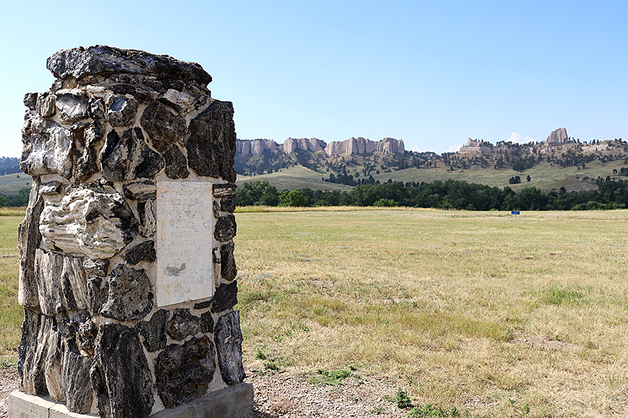
Originally a temporary camp guarding the Red Cloud Agency from 1874-1877, the fort served the U.S. Military in multiple roles until it ceased to be a military post in 1947. In its early days the fort was a significant player in the area’s history and relationship with Native Americans in the region. Many campaigns and expeditions of the so-called Indian Wars originated from the fort and its role in the Cheyenne Outbreak, the death of Crazy Horse, and the relocation of Red Cloud and his people cement the fort as Northwest Nebraska’s most historic location.
Some of the fort’s other prominent history includes its stationing of African American “Buffalo Soldiers” in the early 1900s and its serving as a German POW camp during World War II. Visitors can easily spend multiple days exploring the fort and learning of its extensive history.
At right are locations within the fort that have significant ties to Native American history.
It was near this marker in Crawford, Nebraska, that Baptiste “Little Bat” Garnier was shot and killed in December of 1900.
Garnier was a well-known figure during the frontier days in the region of Northwest Nebraska. Author James H. Cook labeled Garnier as one of the best known of the U.S. Army scouts and interpreters in the land of the Lakota Sioux.
The son of a French-Canadian father and Lakota Sioux mother, Garnier was a skilled hunter and one of the most respected men on the western frontier. He would eventually be named chief of scouts at Fort Robinson and also served as a member of General George Crook’s command during his Black Hills campaign. He also served under Colonel Merritt’s 5th U.S. Cavalry.
On the night of December 16, 1900, “Little Bat” was shot by bartender James Haguewood at what was then Dietrich’s Saloon. Garnier drew his last breath near the center of the nearby intersection around 3 a.m. Haguewood was eventually acquitted on the grounds of self-defense, though “Little Bat” was reported to have been unarmed.
You won’t find a sign marking it, but this area between the White River and the creek is where Crazy Horse and his 1,100 followers made their camp after surrendering at Camp Robinson on May 6, 1877.
Crazy Horse would spend his last days in this camp location before fleeing to the Spotted Tail Agency in Beaver Valley when word got out that he was to be detained at Camp Robinson.
The area of Crazy Horse’s camp is now on private property but can be admired from the roadside.
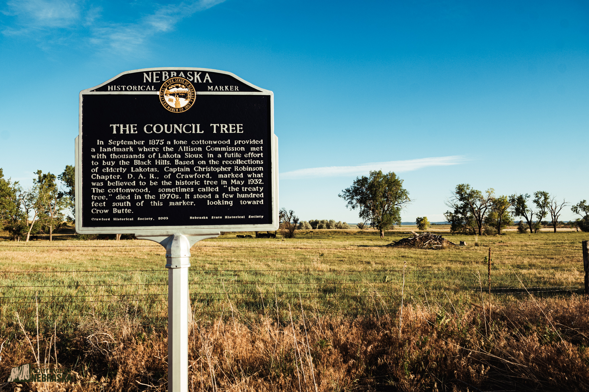
In September of 1875, just south of this monument, the Allison Commission met with Native Americans to discuss the potential sale of the Black Hills.
The Black Hills, among the most sacred of Native American lands, had been rightfully and legally allotted to the Sioux through the Fort Laramie Treaty of 1868, but an influx of whites looking to strike it rich from gold in the hills violated the treaty and threatened war.
Earlier in the same year, Oglala Chief Red Cloud and Brule Chief Spotted Tail made a journey to meet with President Ulysses S. Grant in Washington D.C. but would not speak for their people regarding the fate of the Black Hills. Thus, Senator William Boyd Allison, of Iowa, was chosen to lead a commission to visit with the tribes near Red Cloud Agency and secure the sale.
The conference hosted around 20,000 Lakota, Cheyenne and Arapahoe, in this area. There was little agreement among the Native Americans regarding the sale of their land and the negotiations were contentious. Leaders like Sitting Bull and Crazy Horse refused to attend. Senator Allison’s first suggestion was that the U.S. government lease the land until such time that all the gold was removed from the hills, a proposal that was immediately rejected by the Native Americans, but both Spotted Tail and Red Cloud were amicable to selling the land in part due to their belief that they would lose it to the whites eventually – an accurate assumption.
Indian Agents at the meeting suggested a fair price for the land could be as much as $50 million, which added to the government’s difficulty in negotiating the sale. Red Cloud countered the government offer to lease the land by asking that his people be taken care of for seven generations following the sale. Eventually the commissioners made a final offer – they’d lease the land for $400,000 per year or purchase it for $6 million. The offer was refused, and the council adjourned.
In the wake of the failed purchase attempt, President Grant determined the U.S. military would no longer attempt to stop the unlawful trespass of whites into the Black Hills. This decision, and another that required the Northern bands to be relocated to the agencies, put the government and Natives back onto the path of war. About nine months later, Custer would be defeated and killed in battle near the Little Bighorn River by Sitting Bull, Crazy Horse, and their followers. Despite the victory, the Natives eventually lost the Black Hills. The U.S. Supreme Court would rule in the late 70s and 80s that the land was taken illegally from the Sioux.
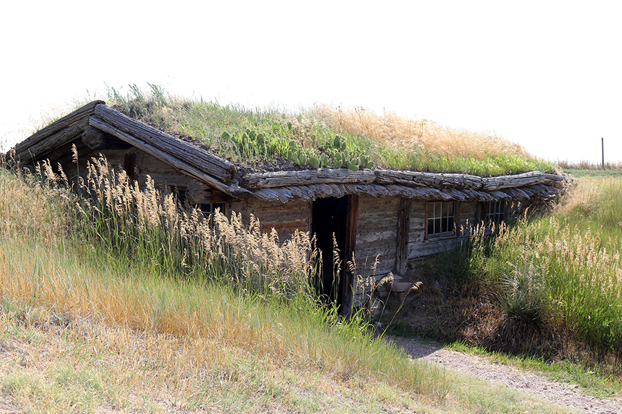
The museum was founded by Charles E. Hanson, Jr., and houses over 6,000 artifacts of the fur trade. Among the exhibits are the oldest known point blanket (made in 1775) and a large collection of firearms including some owned by Kit Carson and Tecumseh. While at the museum, be sure to make your way outside to the south and the site of James Bordeaux’s trading post, established in 1837 for the American Fur Company, which still stands on the property.
The White River and the creeks throughout the region, which lay along the route of the Fort Pierre to Fort Laramie trade route, played an important role in the fur trade of Northwest Nebraska and the larger region. Joseph Bissonette, Henry Chatillion, Louis Chartran and Hubert Rouleau were well-known traders and mountain men who frequented the area, but perhaps none were as well-known as Bordeaux for his prowess in the local business. Some came to refer to the area as “Bordeaux’s District.”
The selling of Fort Laramie and Fort Pierre to the military and the changing nature of the relationship between whites and Native Americans in the region took their toll on the trade business and in 1872 Bordeaux and his eldest son gave up the post.
Famously, Bordeaux’s trade business nearly met its fate during its first winter in 1849 when it was raided by a Crow war party that looted and attempted to set fire to the post. The Crow absconded with as many as eighty horses and mules belonging to Bordeaux, but were pursued by a group of Brule who camped in nearby Beaver Creek (in modern-day Sheridan County). The Crow broke off a contingent of warriors meant to stall the Brule pursuit and the two groups of Natives had an altercation at a butte just east of modern-day Crawford. The butte is still known as Crow Butte and is featured in our Crow Butte – Ponderosa Roads Less Traveled adventure. Though there was just one casualty of the battle, the altercation impacted the fur trade in the region when it discouraged company officials from building a large trading post along the White River to replace Fort Laramie and serve the Sioux.
A sign marks the former location of Camp Sheridan along Beaver Road north of Hay Springs, Nebraska. Standing near the sign, look to the northwest to a cliff-face with the creek running in front of it. It was this cliff-face that provided the backdrop of Camp Sheridan.
This location was the third and last of Camp Sheridan and the first to be built-up with permanent structures. Like Camp Robinson to the west, Camp Sheridan was established to oversee an Indian Agency in the area. While Camp Robinson oversaw the Red Cloud Agency, Camp Sheridan oversaw the Spotted Tail Agency, a location not much farther south along Beaver Road. As the agency moved, so did Camp Sheridan, until 1875 when its final location was established, and permanent construction began under the supervision of Captain Anson Mills of the Third Cavalry.
One second lieutenant noted in his diary that the layout of the camp resembled that of a coffin. The camp featured three company barracks, often housing two companies of infantry and one of cavalry, along with seven officer’s quarters, a hospital, guardhouse, blacksmith, and storehouses. The garrison tended to be small, in part because Spotted Tail’s camp and the Brule were known for their cooperation and required little in the way of direct attention.
In addition to providing protection for the agency, Camp Sheridan also took on the task of scouting and apprehending miners bound for the Black Hills after Custer’s 1874 expedition found gold there. At the time, entry into the Black Hills was illegal as it was Native American territory. One of Camp Sheridan’s most well-known achievements was the interdiction of a mining company led by John Gordon, of Iowa. In October of 1877 the Brules and Oglalas of the Spotted Tail camp were forcibly moved onto the Dakota Reservation and farther near the Missouri River, and again in 1878 to an area north of Camp Sheridan that would later become the Pine Ridge and Rosebud reservations. But Camp Sheridan would not follow the camps as it had in the past.
With nearby Fort Robinson set to be expanded, and the building of Fort Niobrara to serve the Rosebud Agency, Camp Sheridan was deemed no longer necessary and shut down in 1880. Its log buildings were salvaged for lumber and its flagstaff was requested to be moved to the agent at Pine Ridge. In 1882, the final pieces of the fort’s existence disappeared when the few graves that made up the camp cemetery were moved to the Fort Robinson Cemetery.
About three-quarters of a mile south of Camp Sheridan on Beaver Road you’ll come across the former site of the Spotted Tail Agency. Like other agencies, the Spotted Tail Agency was created as a means of controlling trade between the U.S. and Spotted Tail’s Brule and other Lakota tribes camped in the area.
The agency provided rations and equipment to the camps and its agent acted as an ambassador between the Native nations and the U.S. government. The agencies tended to shift locations as the Natives moved in the area, and Spotted Tail was no exception. After being moved from Dakota Territory where it was known as Whetstone, the agency located on a site on the White River and was renamed Spotted Tail Agency. From there, the agency was moved to the location of this marker where it would exist until Spotted Tail’s Brule and the other Lakota were moved back into Dakota Territory in 1877. During its time in Beaver Valley the agency remained generally quiet and peaceful.
Continuing south of the agency Beaver Road takes you through the heart of Beaver Valley. One to five miles south of the agency was the location of Spotted Tail’s Camp though its exact location has yet to be determined as it has only been marked on hand-drawn maps. This southern region of Beaver Valley was a favorite camping destination of Lakota taking hunting trips in the area. Stinking Bear, Fast Thunder, and the parents of Crazy Horse all had lodges in the valley. Crazy Horse often stopped in the area to stay and take part in religious ceremonies.
Among the many Native Americans who camped in the area, few are more famous than Crazy Horse. The Oglala War Chief was known to have established a wilderness camp at one point in the area and took vision quests among the valley’s buttes. Some theories claim Beaver Valley is home to his final resting place among the buttes. Many theories exist as to where Crazy Horse may have been buried, but it is known, at least, that his body was brought to Spotted Tail’s camp in the valley by Crazy Horse’s parents after he was killed at Camp Robinson.


